OUT OF MEMORY↗
projeCts
CODE
LAB
AI
about
Projets
Tags
Plotly
A Python library for creating interactive visualizations with dynamic charts and dashboards.
↘
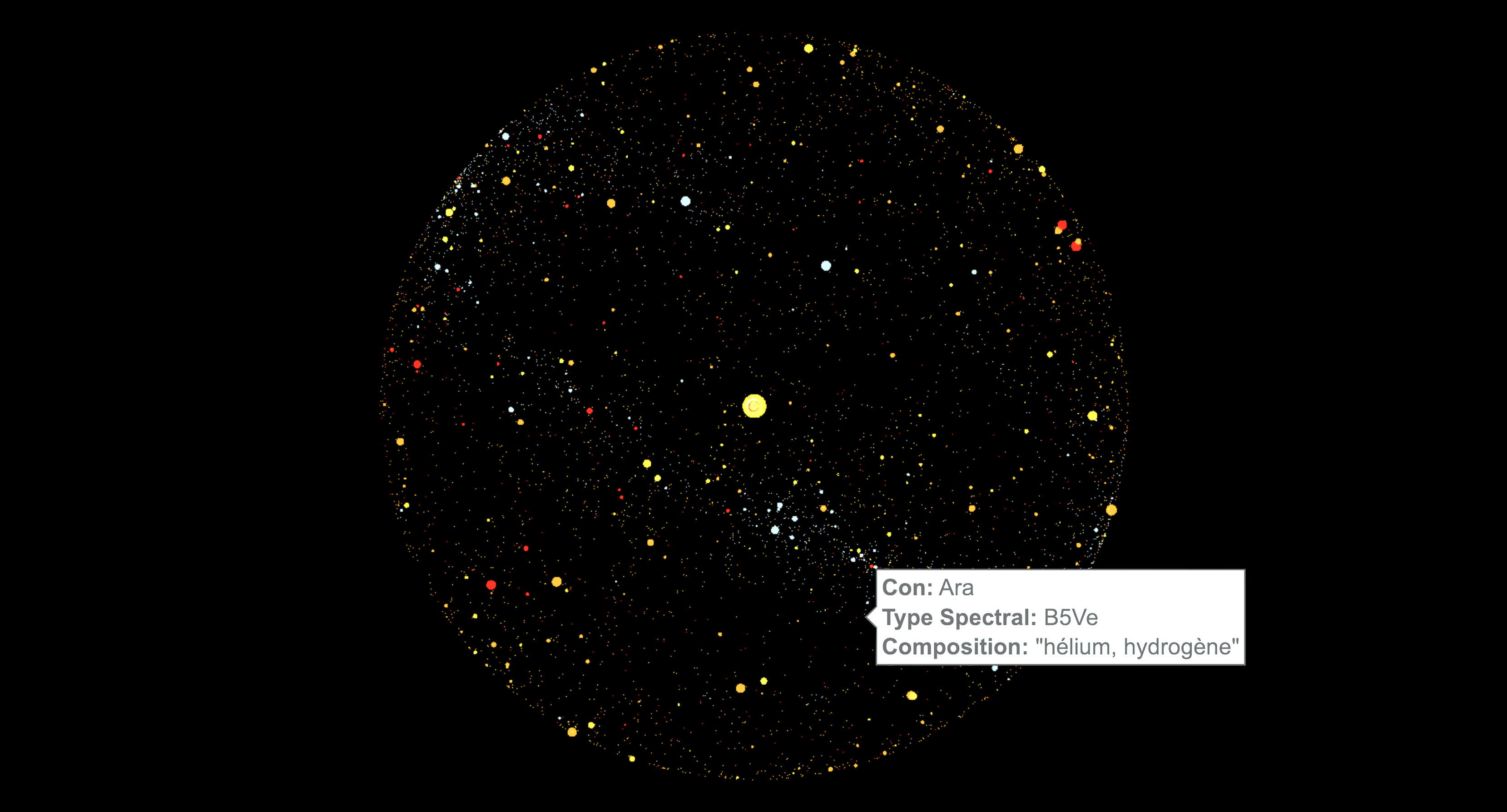
Astral map
The Cartesian coordinates of 300 000 stars, in a system based on the equatorial coordinates as seen from Earth.
Client
Cité des sciences
Date
Description / Link
Interactive 3D scatter plot
Dataset / Code
HYG star database archive